


Limehills/Centre Bush flood risk summary
Flood Risk
The existing flood banks along the Ōreti River were upgraded between Wallacetown and Lumsden in the early 1990s and are designed to reduce the effects of flooding in the Limehills–Centre Bush area based on past recorded floods (including 1978, 1980, 1984 and 1987).
However, in the Limehills–Centre Bush area, those floods had return periods of only 15 to 20 years, so the level of service is low in statistical terms. The flood banks are not designed for more significant flows. At Centre Bush, the flood banks are constructed to contain a flow of 1200 cumecs. The February 2020 flood was a 15-year return period event on the Ōreti River with a recorded flow of 1060 cumecs. A 100-year return period flow at Centre Bush is 1699 cumecs. There will always be residual flood risk due to potential flood-bank failure or the design capacity of the flood infrastructure network being exceeded.
Future flood risk predictions for Southland
The Ministry for the Environment’s climate change projections for Murihiku Southland include an increased frequency of heavy rainfall events and an increased likelihood of extreme rainfall. They also project up to a halving of flood return periods by 2040 and a fourfold reduction by 2090.
Recommendations
The Southland Regional Policy Statement 2017 directs Southland councils to reduce risk to communities from natural hazards. Given the low level of service in the Limehills area, Environment Southland recommends that any dwelling erected in the area have a minimum floor level of no less than 600 millimetres above the existing ground level and that the floor level of non-living areas, such as attached garages and laundries, is no more than 300 mm below the floor level of the dwelling.
For detached garages and sheds, Environment Southland recommends constructing the floor level as high as practicable to minimise potential flood damage to the building and its contents. The interpretation of “as high as practicable” should be left to the owner’s discretion.
Please note that this recommendation is not based on flood modelling and is a practical approach to mitigating residual flood risk. A more conservative approach could be adopted to further reduce residual flood risk.
Understanding return periods
A return period describes the probability of a flow of a specific size occurring in a river or stream; a 100-year return period means the event occurs on average once every 100 years.
Another way of measuring flood risk is the annual exceedance probability (AEP). AEP is the probability of a specific size of flood flow occurring in a single year. A 1% AEP flood flow has a 1% (1 in 100) chance of occurring in any one year. If a 1% AEP flood flow were recorded this year, the probability of another flow of that size occurring in the following year (or any subsequent year) would still be 1%.
Return period | Annual exceedance probability AEP |
100 year | 1% |
50 year | 2% |
20 year | 5% |
10 year | 10% |
5 year | 20% |
2 year | 50% |
Further information
If you require specific information about an address in Limehills-Centre Bush, please get in touch by email service@es.govt.nz or phone 0800 76 88 45
Useful links
Environment Southland recommends developing a flood contingency plan and familiarising yourself with the Ōreti Catchment flood warning system. This may include removing vehicles to high ground if the flood warning system is activated and storing flood-sensitive items as high as practicable.
https://www.es.govt.nz/environment/flood-warning
https://envdata.es.govt.nz/index.aspx?c=water-level
https://www.es.govt.nz/environment/flood-warning/catchment-sites-and-flood-level-travel-times
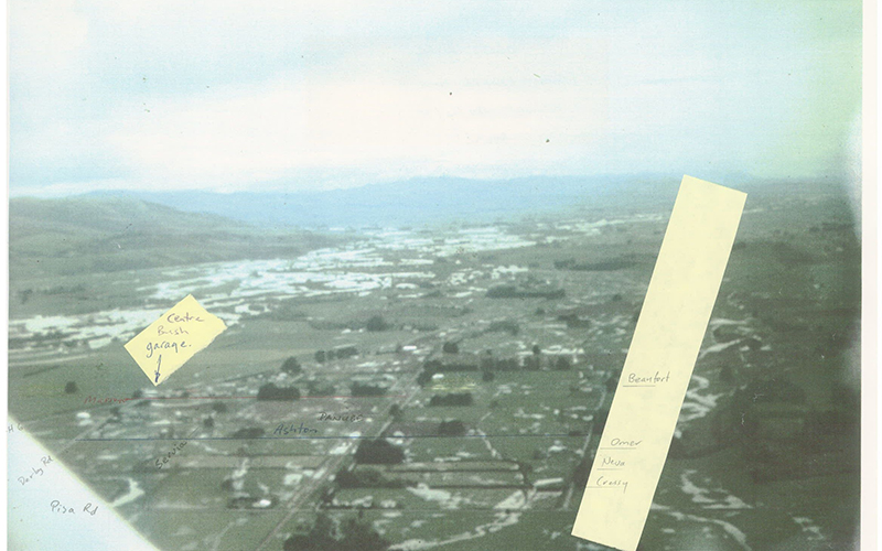
Photo taken during, but not at the peak of, the October 1978 flood - with annotated notes.
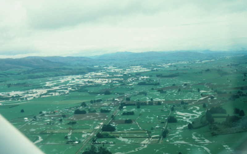
Photo taken during, but not at the peak of, the October 1978 flood.


