Wyndham flood risk summary
Flood risk summary for Urban Zoned land in Wyndham
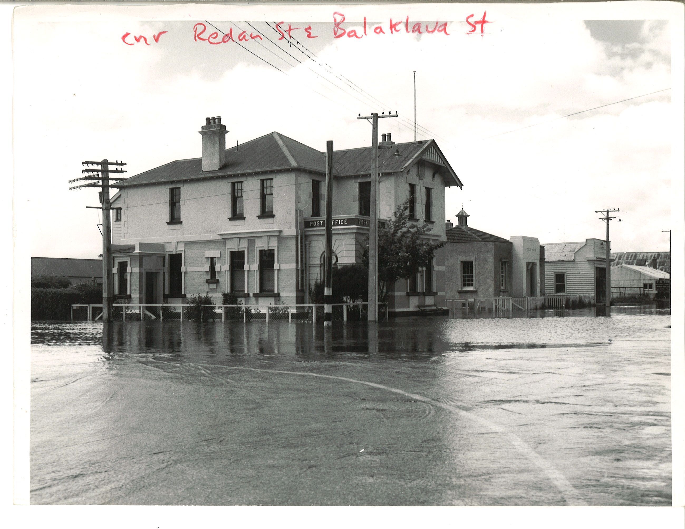
Wyndham Post Office during 1958 flood
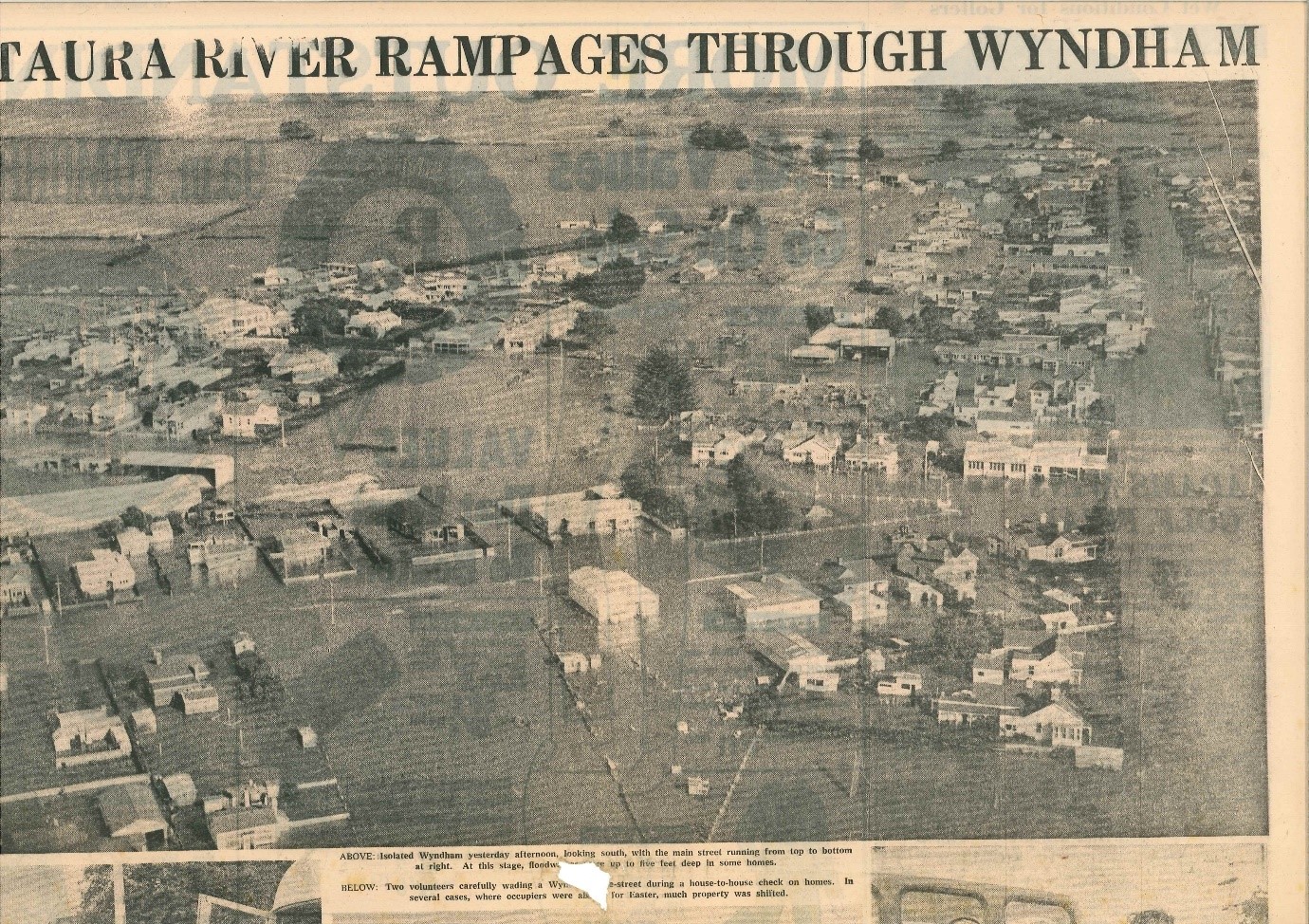
Virtually all of Wyndham township has a history of flooding; the earliest records occur in 1861, 1878 and 1913. Wyndham flooded in the April 1968 event (see figures 1–4). The photograph (right) of the Post Office building on the north-east corner of Redan and Balaclava Streets during the November 1957 flood suggests extensive flooding of Wyndham during that event.
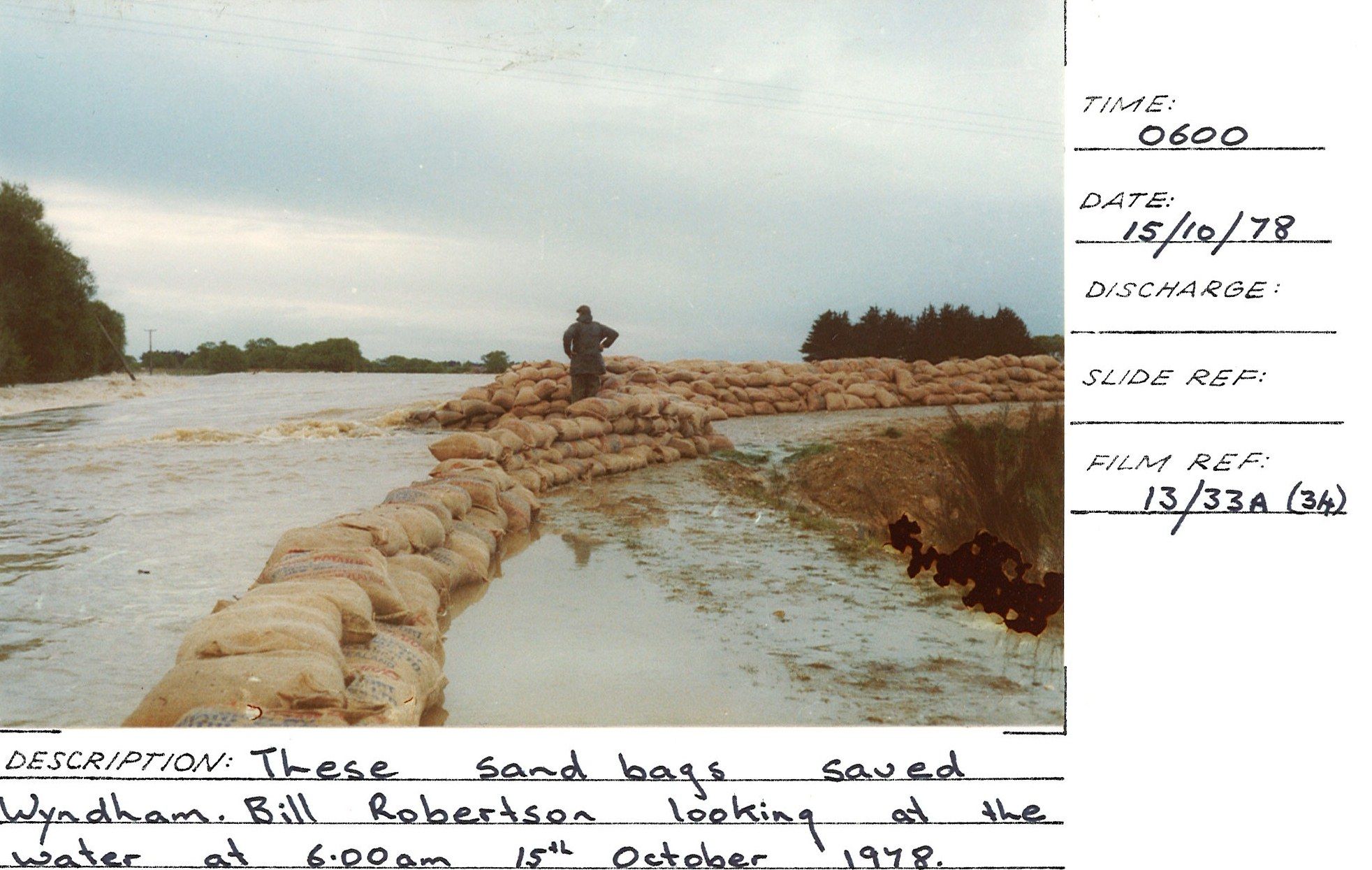
The flood banks at Wyndham were upgraded in 1985 to contain a 1978-sized flow with at least 500 mm of freeboard. However, that level of service relies on sandbagging across the main road into Wyndham during large floods.
See planning maps from the Operative Southland District Plan for the mapped floodplain of the Mataura River and the Mimihau Stream—links to planning maps 83 and 83A.
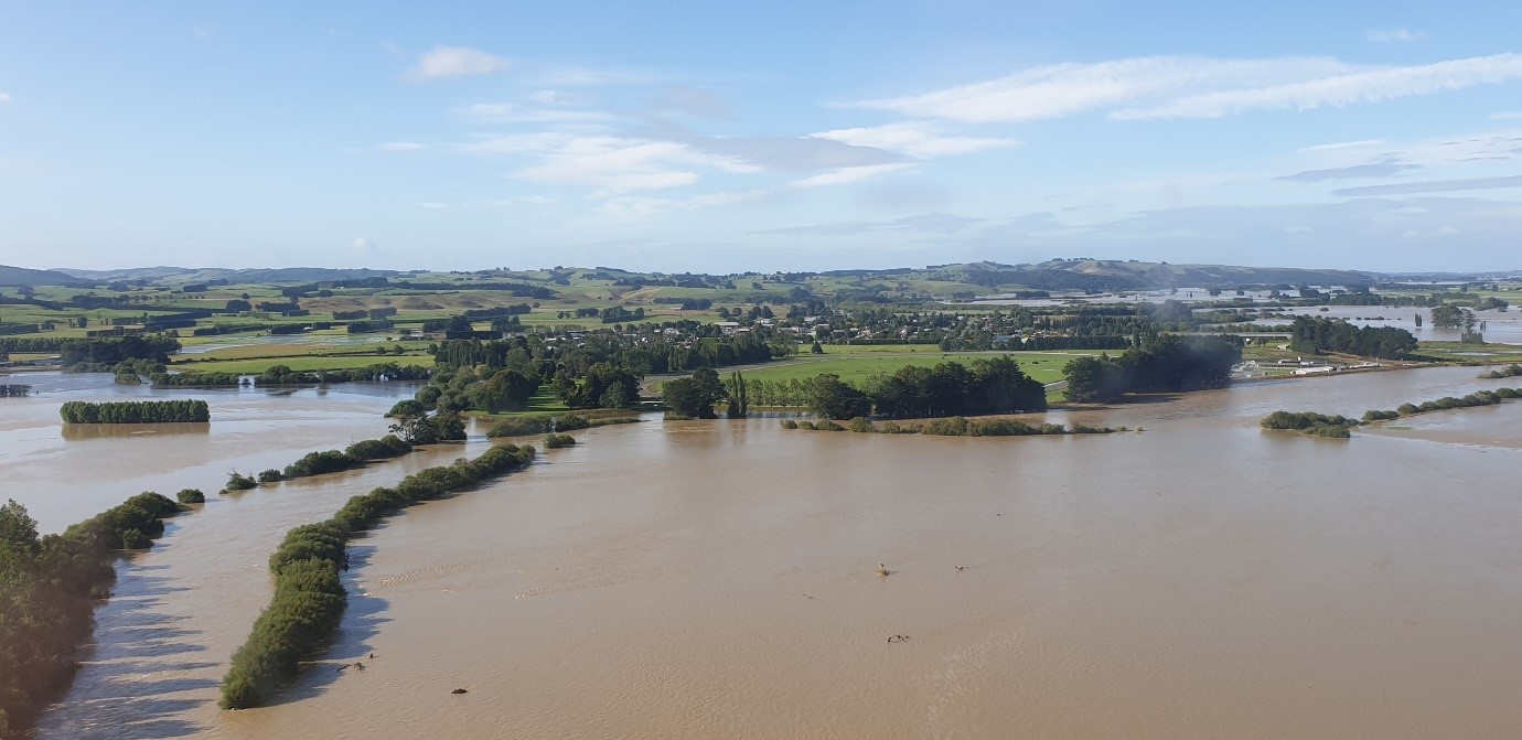
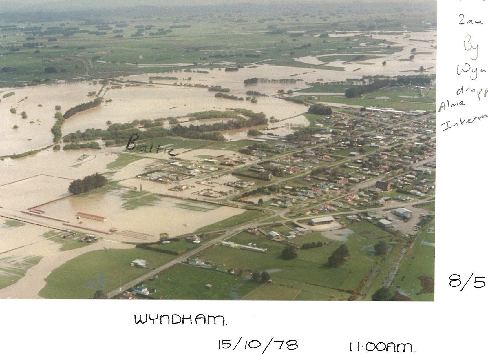
Before the February 2020 event, the 1978 flood was the largest on record at Wyndham, with a return period of about 50–60 years. A 50-year return period flood has a 2% chance of occurring in any given year. During February 2020, the Mataura River recorded the highest flows measured at Pyramid, Gore, Mataura, Wyndham and Seaward Downs. At Gore, the peak flow was 2400 cumecs. Before this event, a flow of 2400 cumecs was estimated to have a return period of approximately 90 years (AEP 1.1%). Following the event, a flow of 2400 cumecs is estimated to have a return period of approximately 70 years (AEP 1.4%). See figures 5–10.
The February 2020 flood approached the design capacity of the flood-bank system through Gore and Mataura. The risk of overtopping at Wyndham was lower than expected due to water spilling onto the floodplain to the west of the town.
Floods in Murihiku Southland are likely to become more frequent as a result of climate change and the associated projected increases in rainfall. The Ministry for the Environment’s climate change projections for Southland include an increased frequency of heavy rainfall events and a higher likelihood of extreme rainfall. They project flood return periods could halve by 2040 and reduce fourfold by 2090
Recommendations
The Southland Regional Policy Statement 2017 directs Southland councils to reduce risk to communities from natural hazards.
Although the level of service in Wyndham is considered high, as with any flood-bank system, there is always residual flood risk due to potential flood-bank failure or to the design capacity of the flood infrastructure network being exceeded.
To further reduce residual risk, Environment Southland recommends that any dwelling erected on Urban-zoned land in Wyndham has a minimum floor level no less than 600 millimetres above natural ground level, and that the floor level of non-living areas such as attached garages and laundries is no more than 300 mm below the floor level of the dwelling.
For detached garages and sheds, Environment Southland recommends that the building be constructed with its floor level as high as practicable to minimise the potential for flood damage to the building and its contents. The interpretation of “as high as practicable” should be left to the owner’s discretion.
Environment Southland recommends that owners/occupants develop a flood contingency plan and make themselves familiar with the Mataura catchment flood-warning system.
Please see our Flood warning page.
1968 flood
Figure 1. Wyndham during the April 1968 flood.
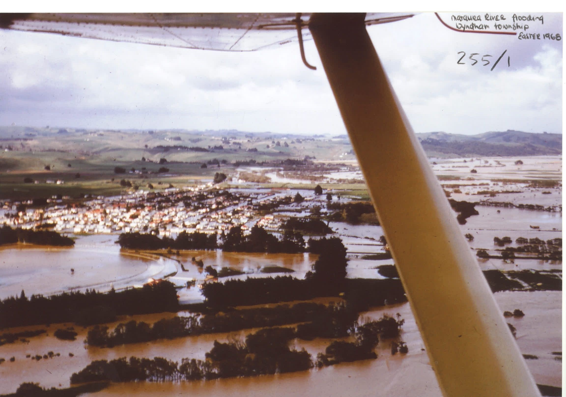
Figure 2. Looking south-east over Wyndham during the April 1968 flood.
Figure 3. Looking east over south end of Wyndham during the April 1968 flood.
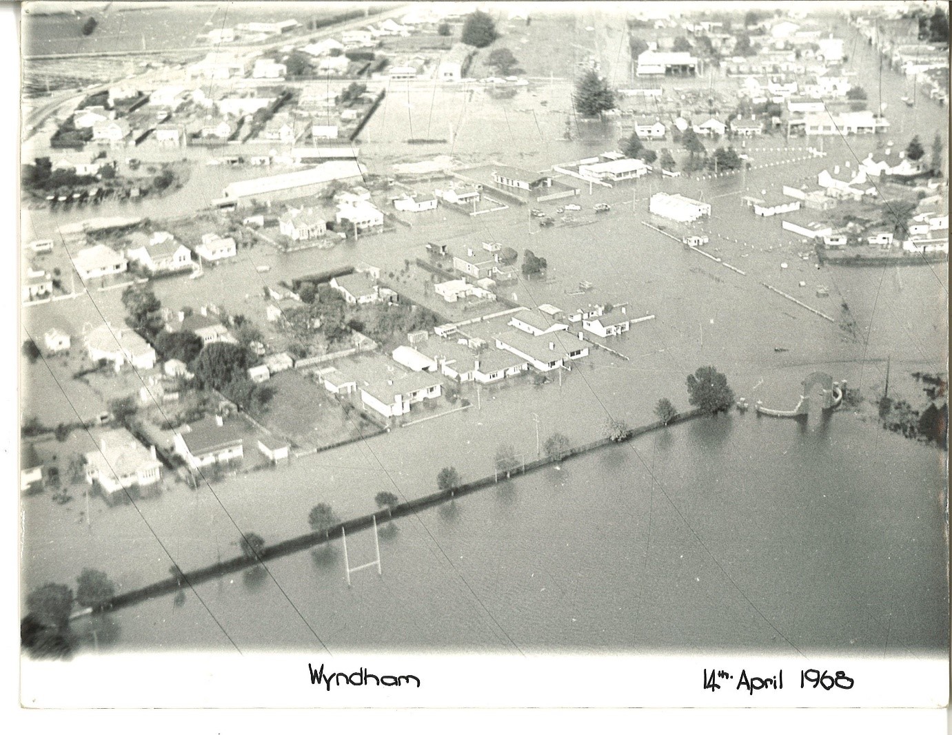
Figure 4. Looking south over the east end of Raglan Street during the April 1968 flood.
1978 flood
Figure 5. Looking north-west over Wyndham during the October 1978 flood.
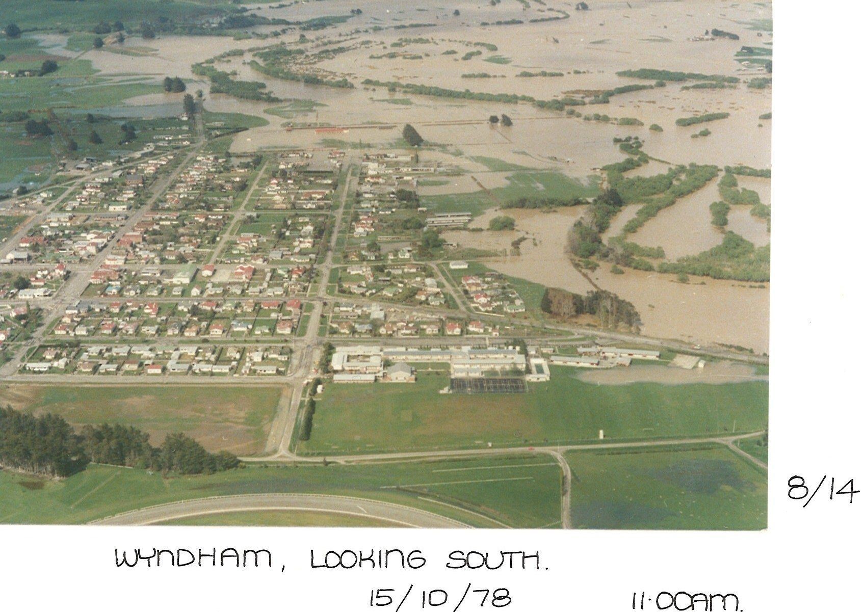
Figure 6. Looking south over Wyndham during the October 1978 flood.
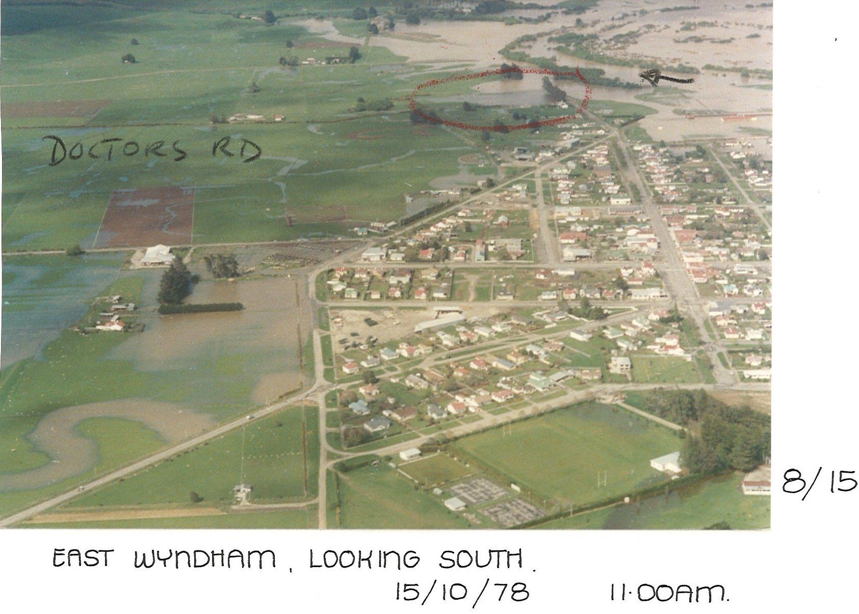
Figure 7. Looking south over Wyndham during the October 1978 flood.
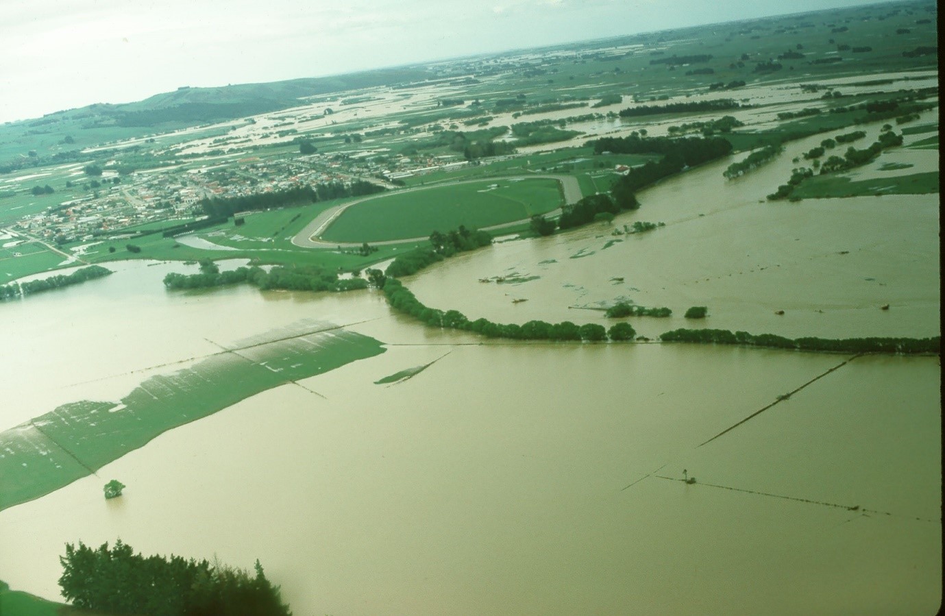
Figure 9. Looking south over Wyndham during the October 1978 flood. Mimihau Stream is in the centre left of the photo.
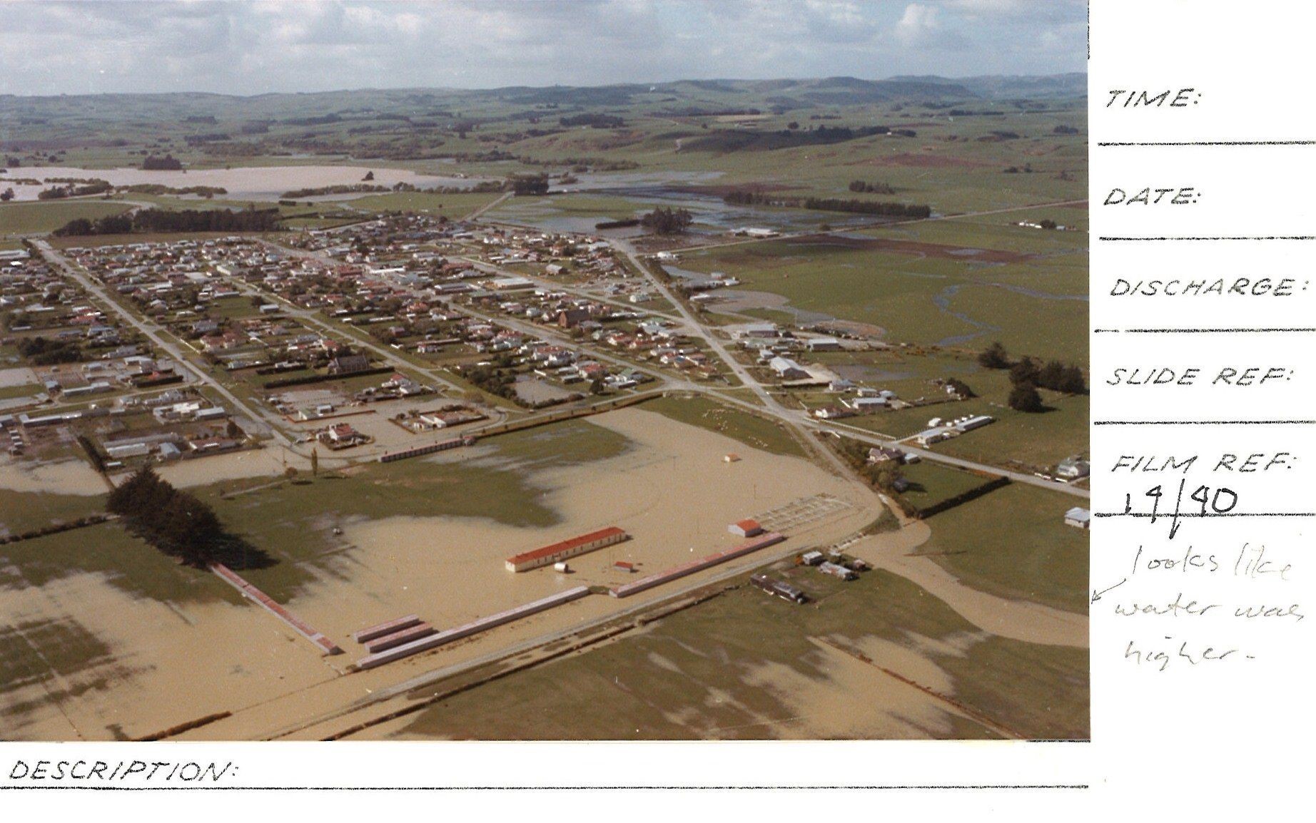
Figure 8. Looking north-east south over Wyndham during the October 1978 flood.
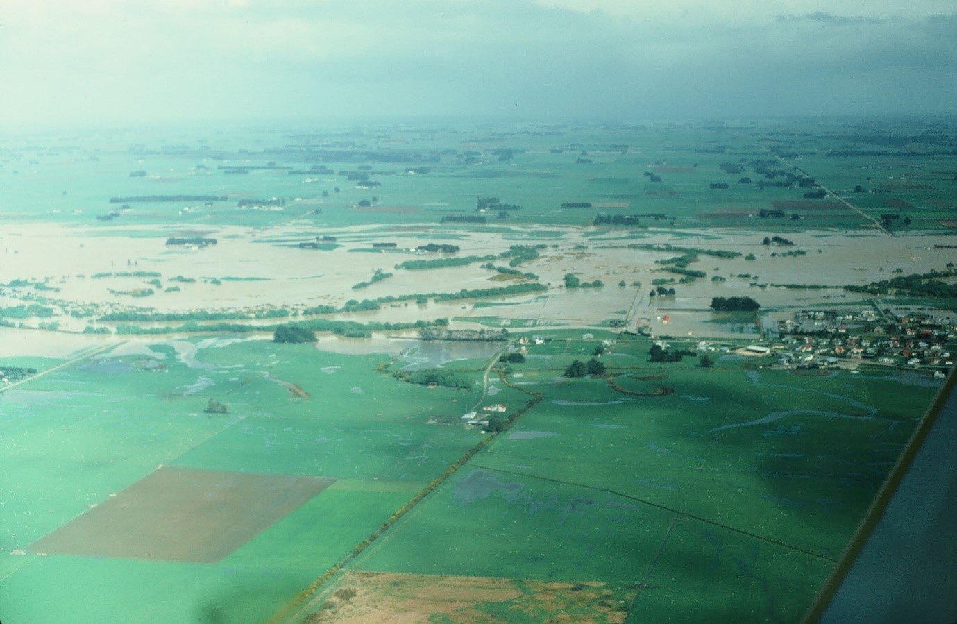
Figure 10. Looking west over the south end of Wyndham during the October 1978 flood
2020 flood
Figure 11. Looking south-east over Wyndham during the February 2020 flood
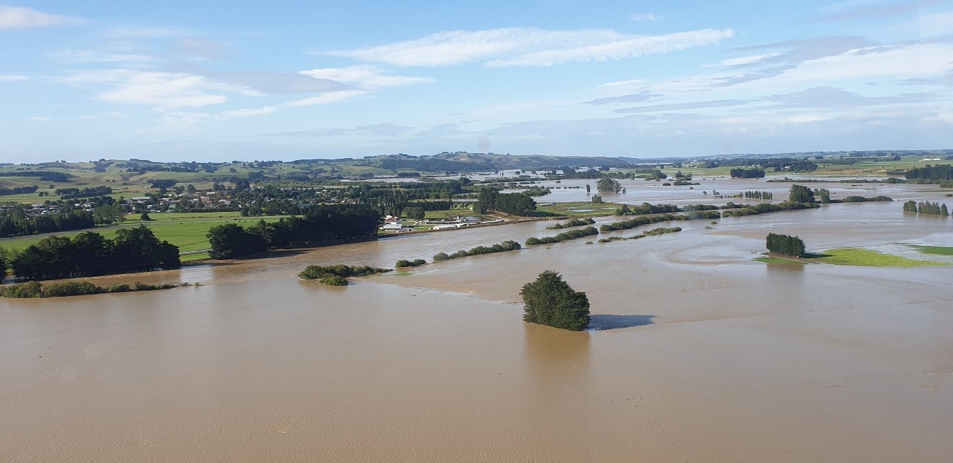
Figure 12. Looking south-east over Wyndham during the February 2020 flood
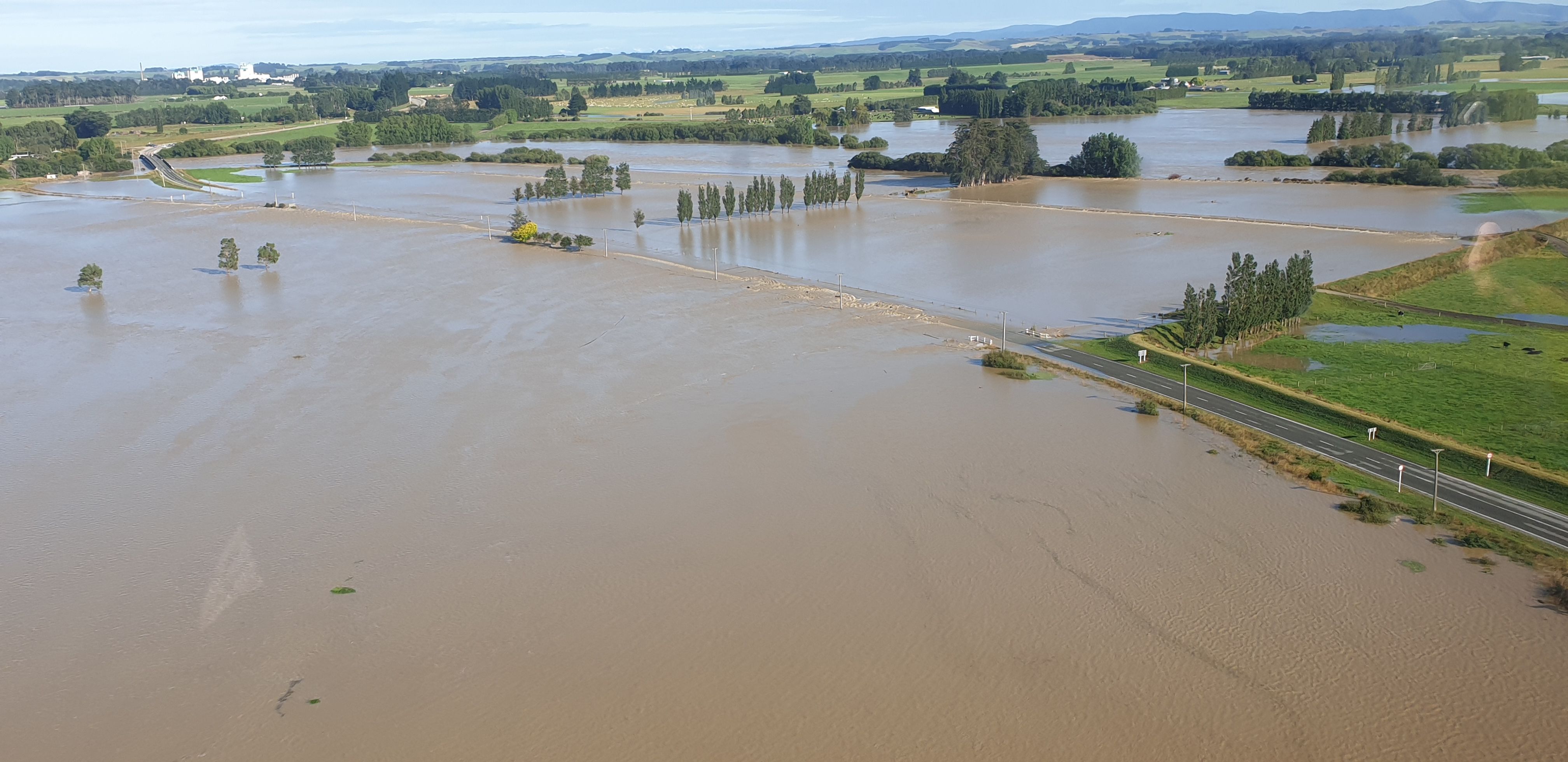
Figure 13. Looking north-west towards Edendale during the February 2020 flood
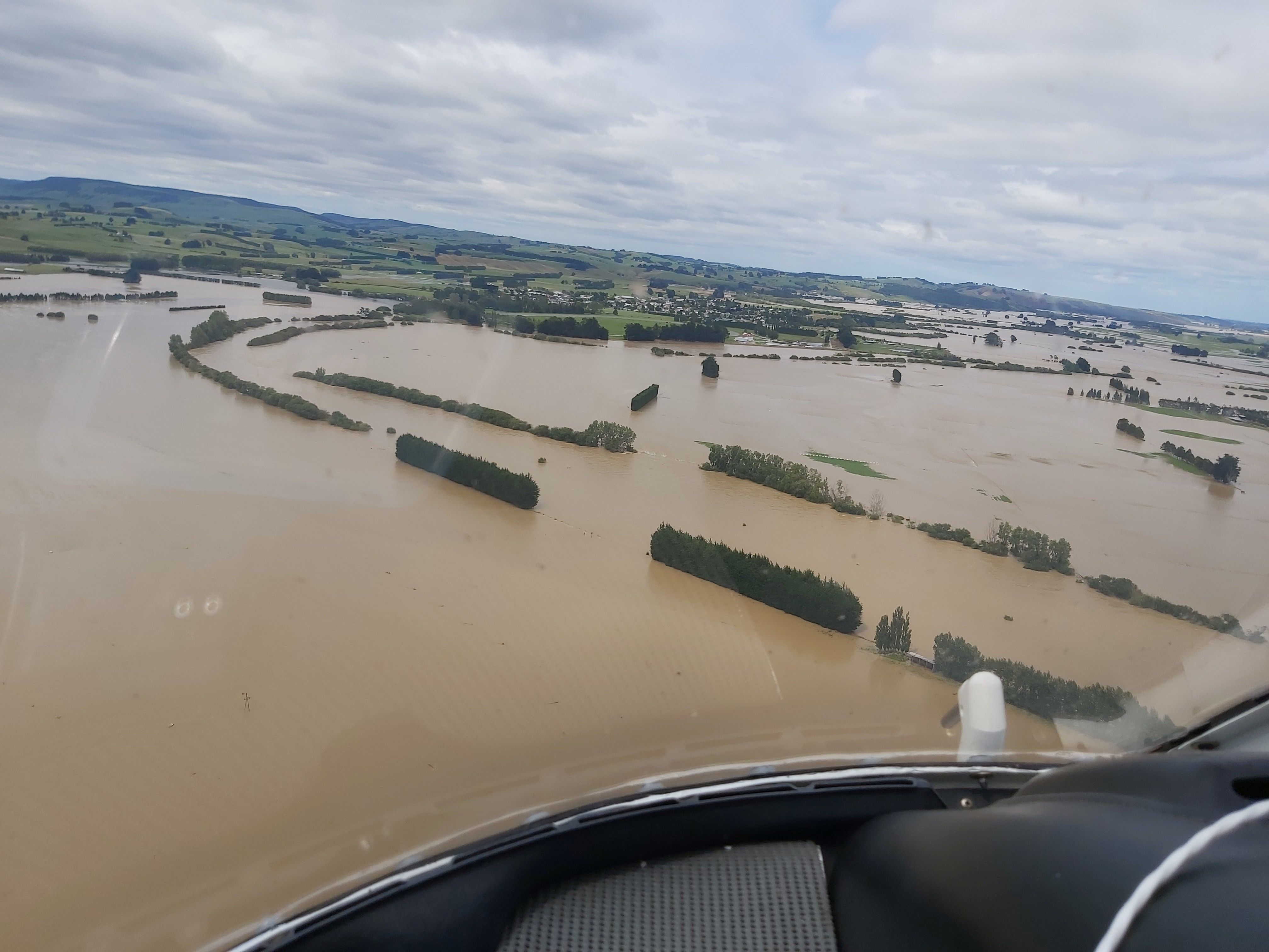
Figure 14. Wyndham during the February 2020 floods.
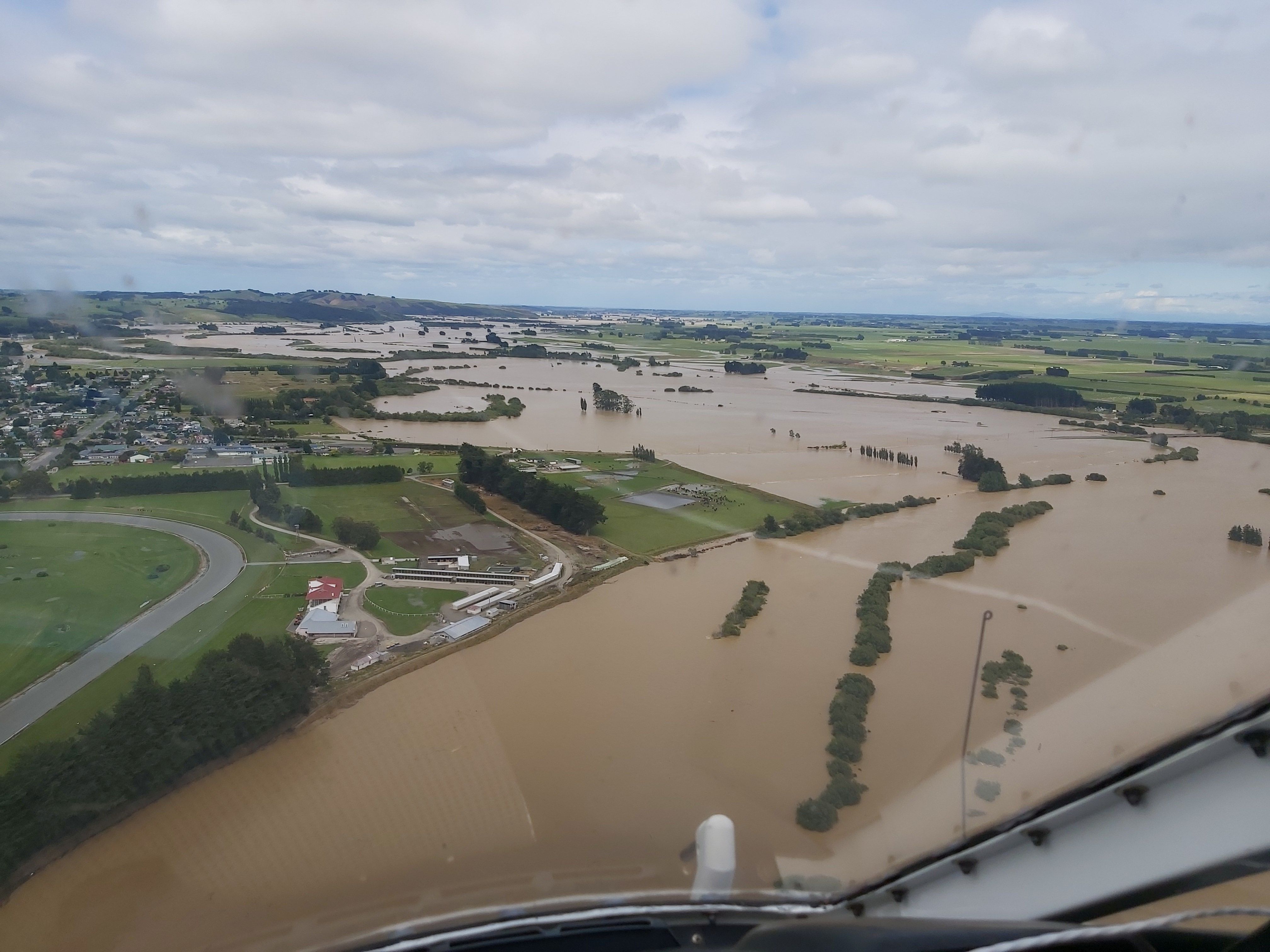
Figure 15. Wyndham during the February 2020 floods.
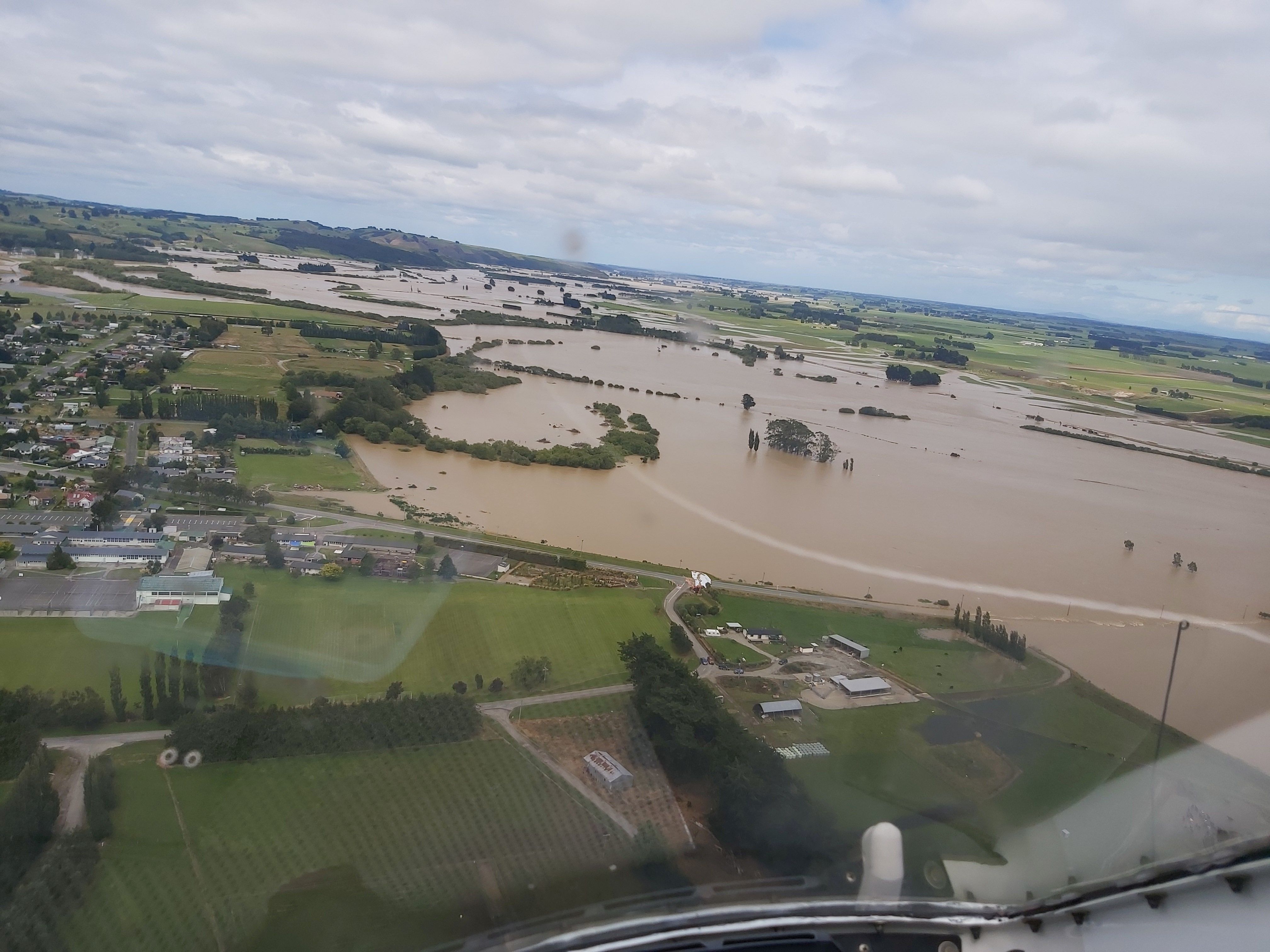
Figure 16. Wyndham during the February 2020 floods.
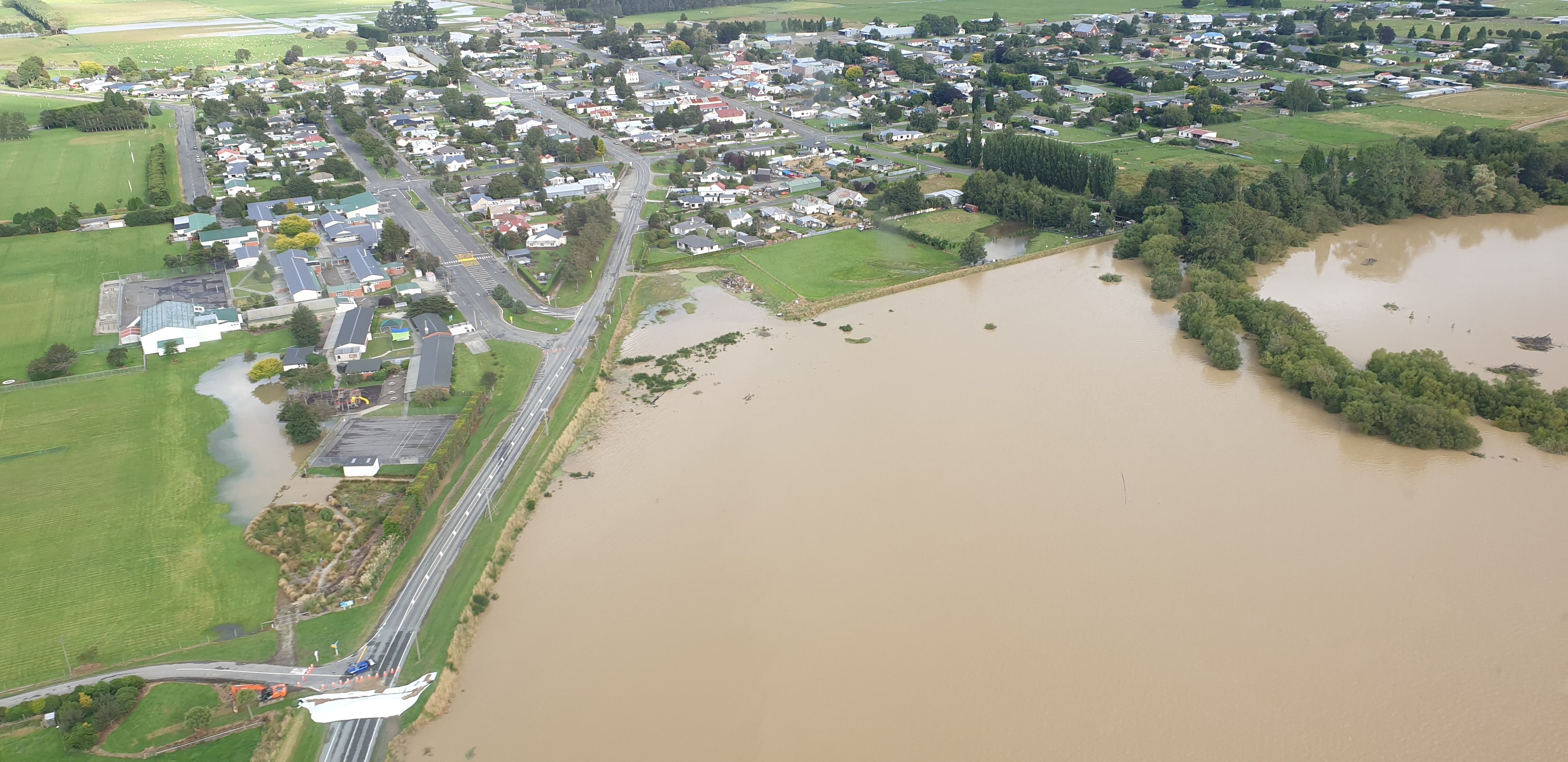
Figure 17. Wyndham during the February 2020 floods.
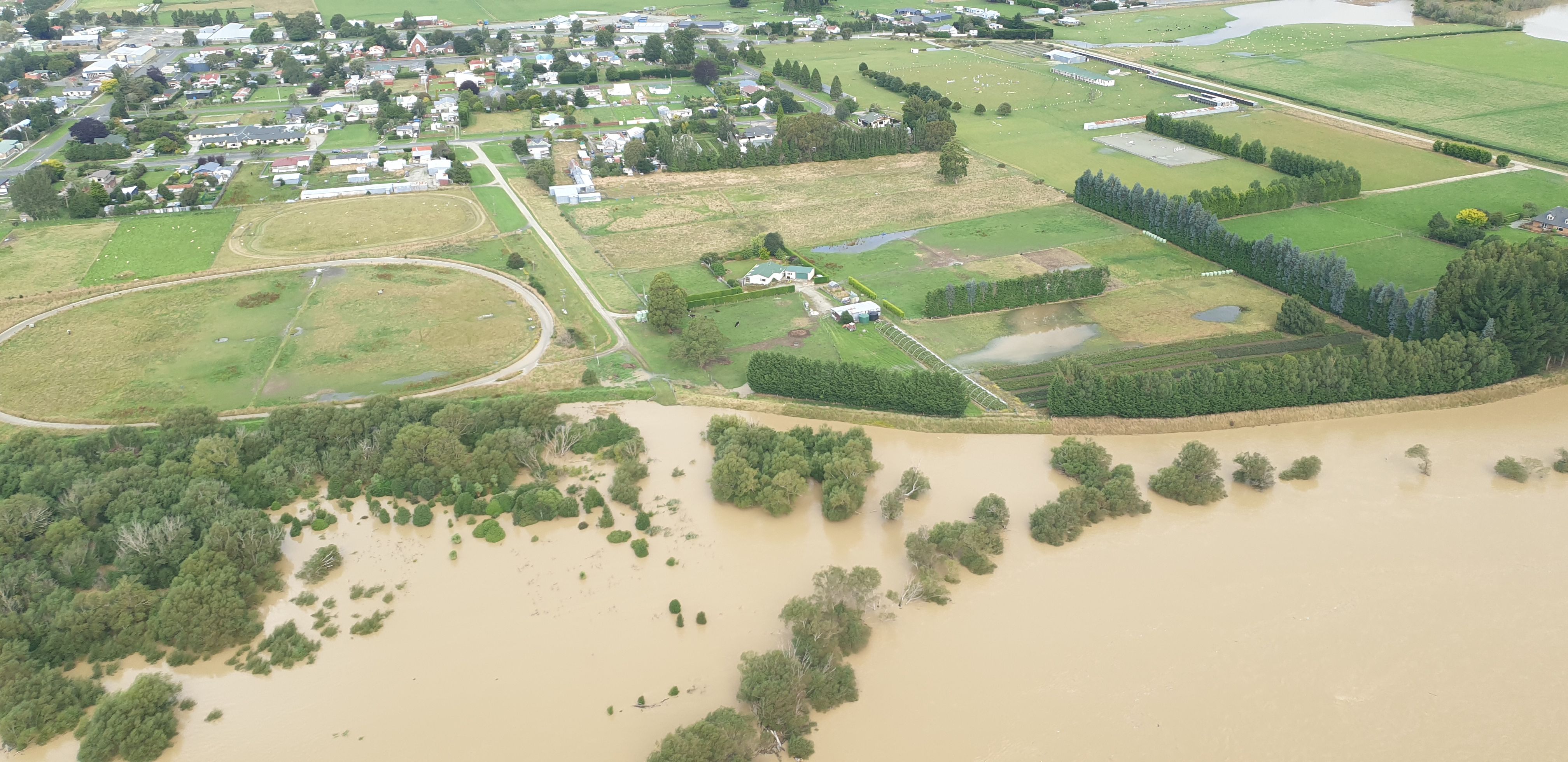
Figure 18. Wyndham during the February 2020 floods.
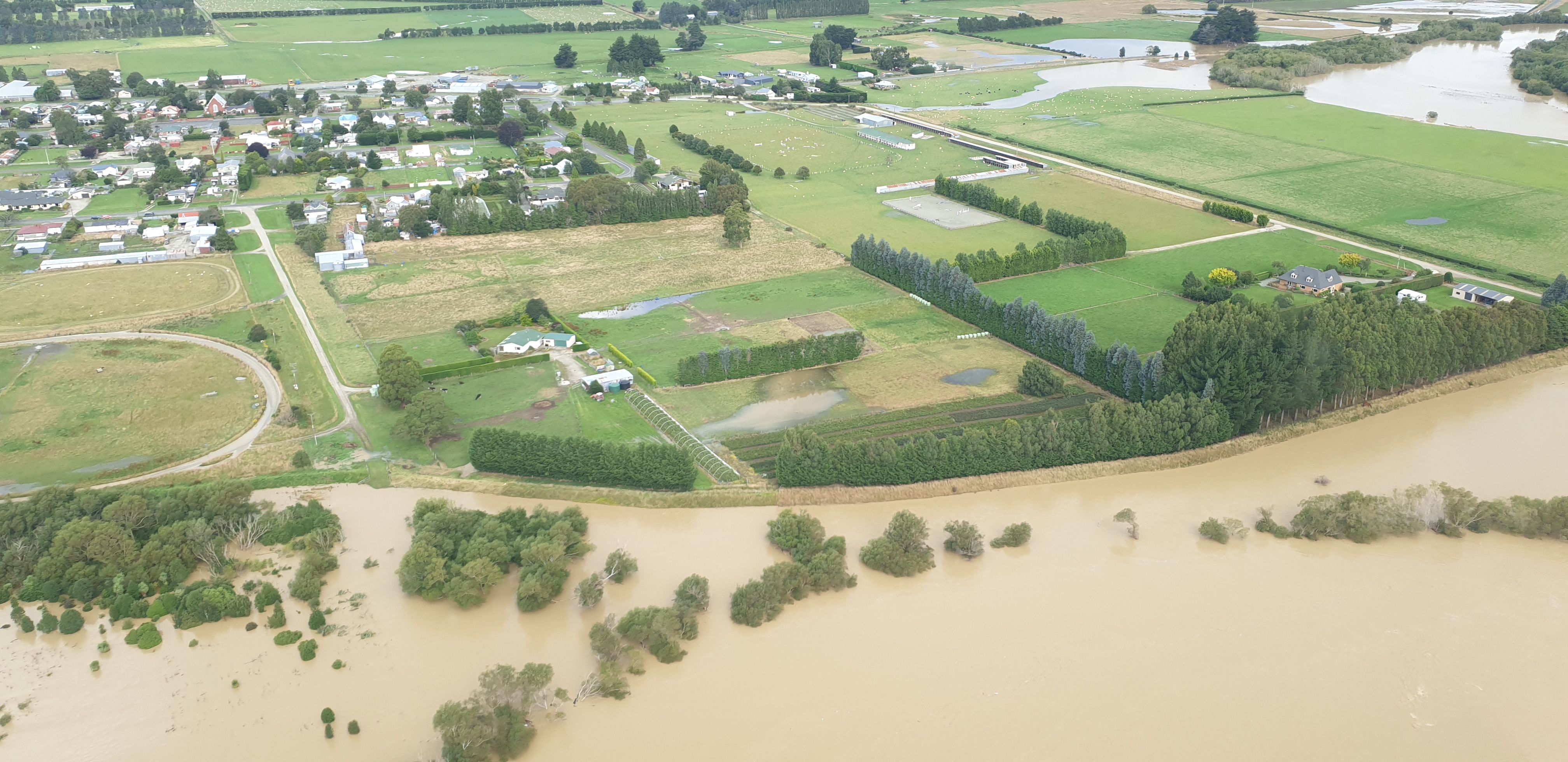
Figure 19. Wyndham during the February 2020 floods.
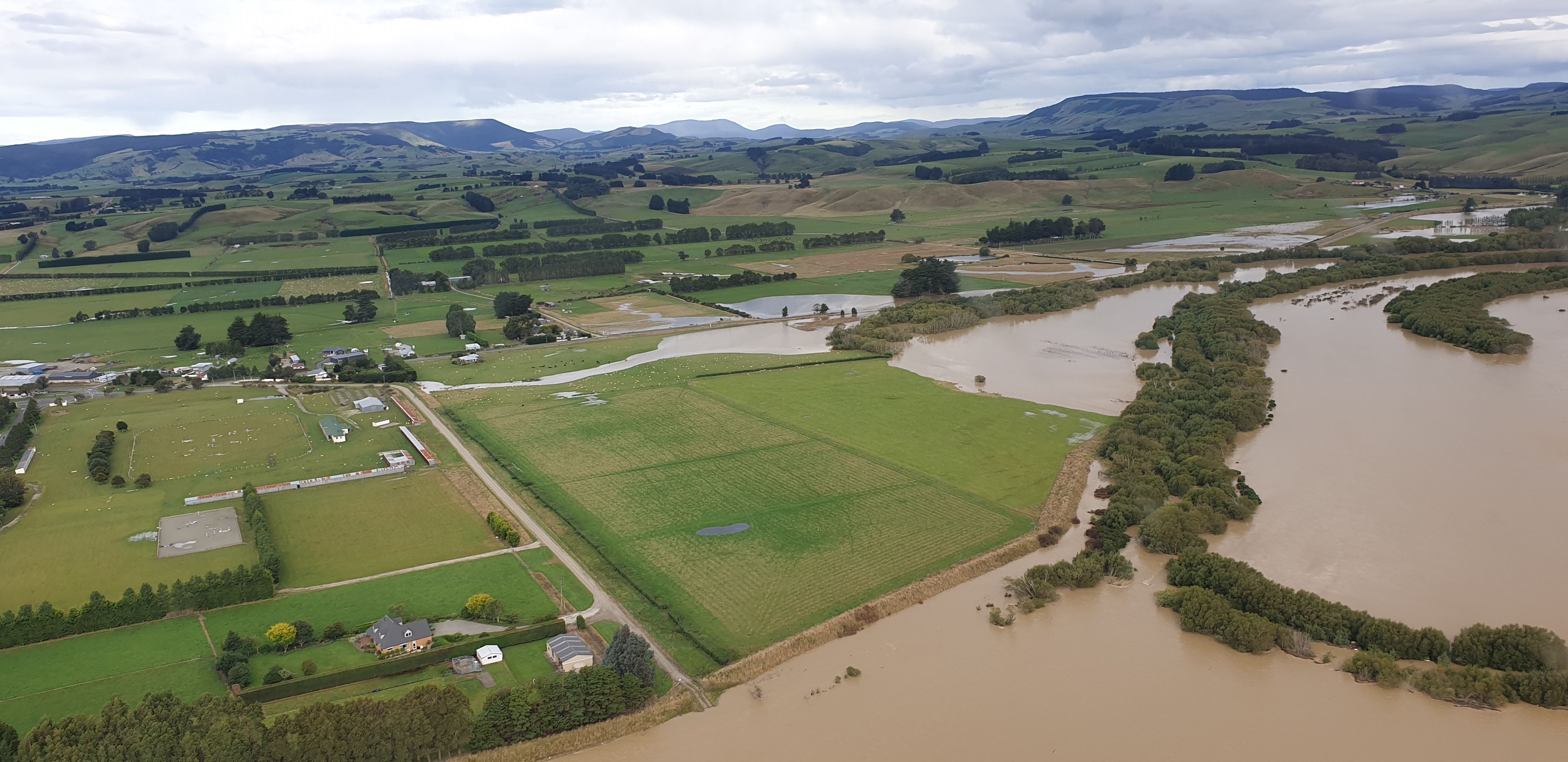
Figure 20. Wyndham during the February 2020 floods.